Anchoring in the Canary Islands: Shelter, Swell and Local Rules
Published
A quiet afternoon anchorage and a restful overnight stop ask different things of a boat. You might accept a little rolling while eating lunch, yet find the same motion exhausting after dark. Add a forecast wind shift, an uncertain landing place or a crowded swinging area, and a beautiful bay can become a poor choice for that particular night.
In the Canaries, choose the anchorage, the period you intend to stay and the departure option together. The useful question is: will this place still work when the next change arrives?
Separate shelter from the wind and shelter from the swell
Calm air can coexist with swell generated far away. Offshore wave forecasts also cannot describe every bay: seabed and coastline shape the conditions near shore. Puertos del Estado explains this distinction.
On the chart, trace the open-water directions into your candidate anchorage. Then compare those with the forecast wind and swell separately. Land between you and the wind is useful; a swell arriving through the bay entrance still needs its own assessment.
Spend time watching before committing. Are boats merely moving around their anchors, or rolling persistently across the swell? Are sets breaking along the intended dinghy landing? Is the apparently empty corner empty because it offers less room or protection? An uncomfortable landing can spoil the plan even when the yacht itself is secure.
Read the island forecast as well as the wind arrow
AEMET documents coastal wind acceleration around Gran Canaria and Tenerife, including during northeast trade-wind conditions. Its study of coastal jets explains why local exposure matters.
For planning, that means checking the passage into the anchorage and the route out as carefully as the spot where you hope to sleep. A comfortable lee can hide the conditions waiting around the next headland. Leave time to evaluate a second option while the crew is fresh and visibility remains useful.
Start with AEMET’s maritime forecasts, selecting the relevant Canary coastal area. Compare the forecast with available observations through Puertos del Estado’s Portus. Note issue times, units and whether times are UTC. Read through the overnight period and your expected departure, rather than stopping at the arrival forecast.
Four areas to evaluate, with different questions
These are examples for passage planning, not confirmation that a particular position is safe or available for anchoring.
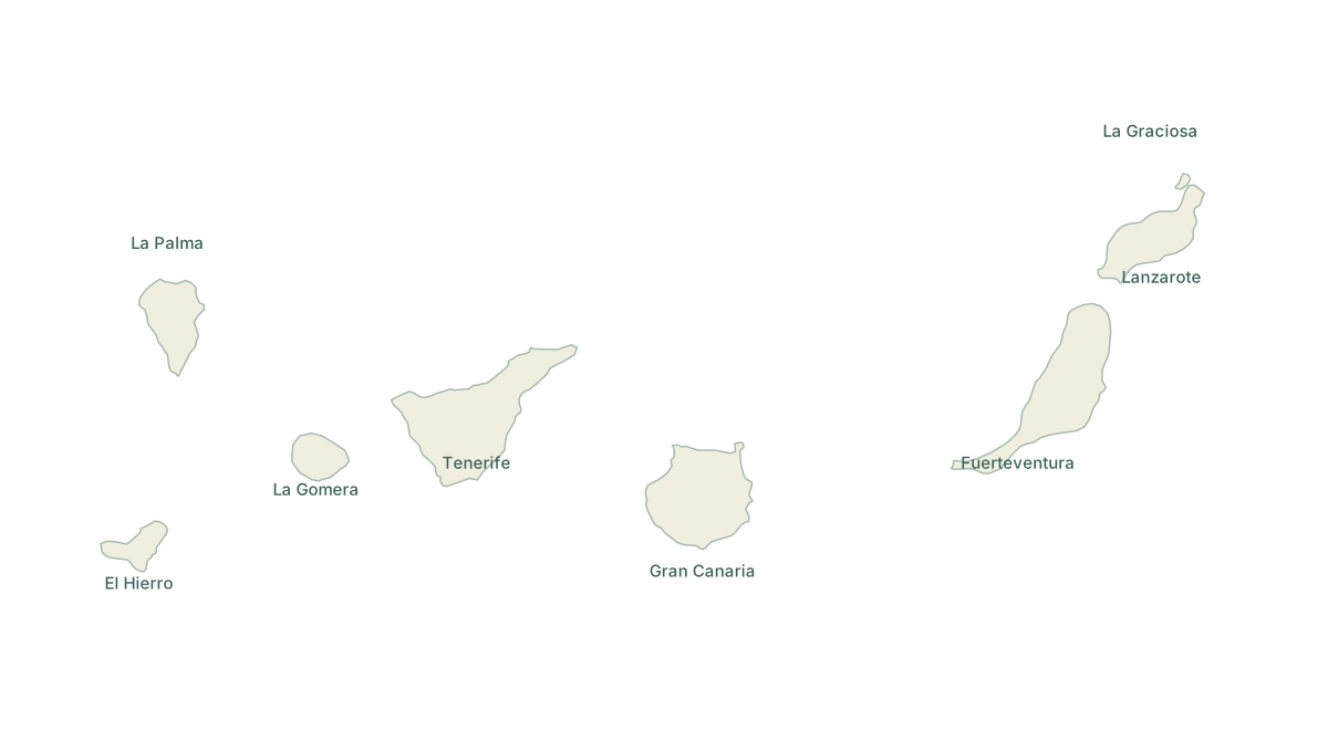
Playa Francesa, La Graciosa
Playa Francesa faces the El Río side of La Graciosa. For your assessment, separate the beach anchorage from Caleta del Sebo harbour and from the wider Chinijo protected area. A favourable view of one says little about the permissions or exposure of the others.
Before making this your destination, ask the Cabildo de Lanzarote’s environment service to confirm the current anchoring procedure, permitted area, dates and any landing conditions. We could not verify a current official anchoring application deadline or complete procedure as of 13 October 2026. Do not base the passage on an old downloadable form. The Canary government’s recreational-fishing authorization concerns fishing; it does not settle permission to anchor.
Papagayo and the Playa Blanca area, Lanzarote
The official Canary tourism page places Papagayo on southern Lanzarote within Los Ajaches. Use the chart to compare the individual coves, their openings and nearby harbour options.
For a practical decision, ask what happens if the wind or swell comes into that opening later. Check swimming areas and local notices before selecting a position; the presence of other yachts is not evidence of permission. If the plan depends on going ashore, watch the landing through several sets before taking the dinghy in. A berth around Playa Blanca is a fallback only after access and availability are confirmed.
Lobos and Corralejo, Fuerteventura
Treat a stop near Lobos and a visit ashore as two separate arrangements. The Cabildo’s current applications page directs island visitors to LobosPass for authorization. That visitor document does not establish where a private yacht may anchor; we could not verify a complete current anchoring-permit procedure.
Corralejo also deserves assessment before being written down as the escape port. Puertos Canarios warns of rocky shoals and entrance waves from the northeast and southeast quadrants. Check the current chart, traffic, port instructions and the conditions expected when you would actually arrive there.
Arguineguín, southwest Gran Canaria
Puertos Canarios locates Arguineguín on Gran Canaria’s southwest coast and publishes berth and anchoring authorization information. Its harbour description applies to the port, not every nearby patch of water.
Use this area to practise distinguishing an enclosed harbour from an open-coast anchorage. Assess the exact opening, the forecast through the night and the room available after a wind change. Ask the port which services are available for your boat and dates. A submitted request or a space that looks vacant is not a confirmed allocation.
Look below the boat, and all around it
Choose a permitted patch of seabed large enough for both the anchor and the chain’s movement. Clear water helps observation, but colour alone cannot establish bottom type or depth. Keep the gear clear of vegetation. Protection can be explicit: within the Sebadales del Sur de Tenerife protected area, MITECO’s guidance prohibits anchoring on seagrass.
Check minimum depth through the tidal cycle, allowing for your sounder offset, draught and the boat’s movement. Decide the required rode from the equipment, conditions and full depth below the bow roller; then see whether the swinging room is sufficient. Shortening the rode simply to fit between neighbours does not solve a cramped anchorage.
A short arrival and overnight checklist
- Permission and notices: confirm the applicable zone, any authorization and current restrictions. Consult Salvamento Marítimo’s navigational warnings alongside current charts and local instructions.
- Weather window: record wind direction, gusts, swell direction, height and period, plus the next expected change.
- Swinging room: include neighbouring boats, shoals, shoreline, moorings and the room needed to recover the anchor.
- Holding: verify that the boat has settled and is holding using position checks and shore references. Set an appropriate anchor alarm as an additional watch aid.
- Crew and equipment: agree who checks conditions, how everyone gets back aboard and whether the anchor can be recovered promptly.
- Exit: name the alternative, its entry constraints and the latest sensible departure time.
If the boat keeps moving towards a hazard, the swell builds beyond what the crew can manage, or the exit window is closing, act on the alternative while it remains viable. Unresolved permission, inadequate room or uncertain holding are reasons to choose another stop.
Sort equipment problems before departure; our guide to finding boat parts in the Canary Islands can help with the shore-side work. Carry current charts and follow local directions: this article is a planning guide, not a pilotage chart.
Sources checked on 13 October 2026. The cover is a generated illustration, not a photograph or a navigational chart.